


3D Modeling of Underwater Deformation: Simulating Geological Chaos
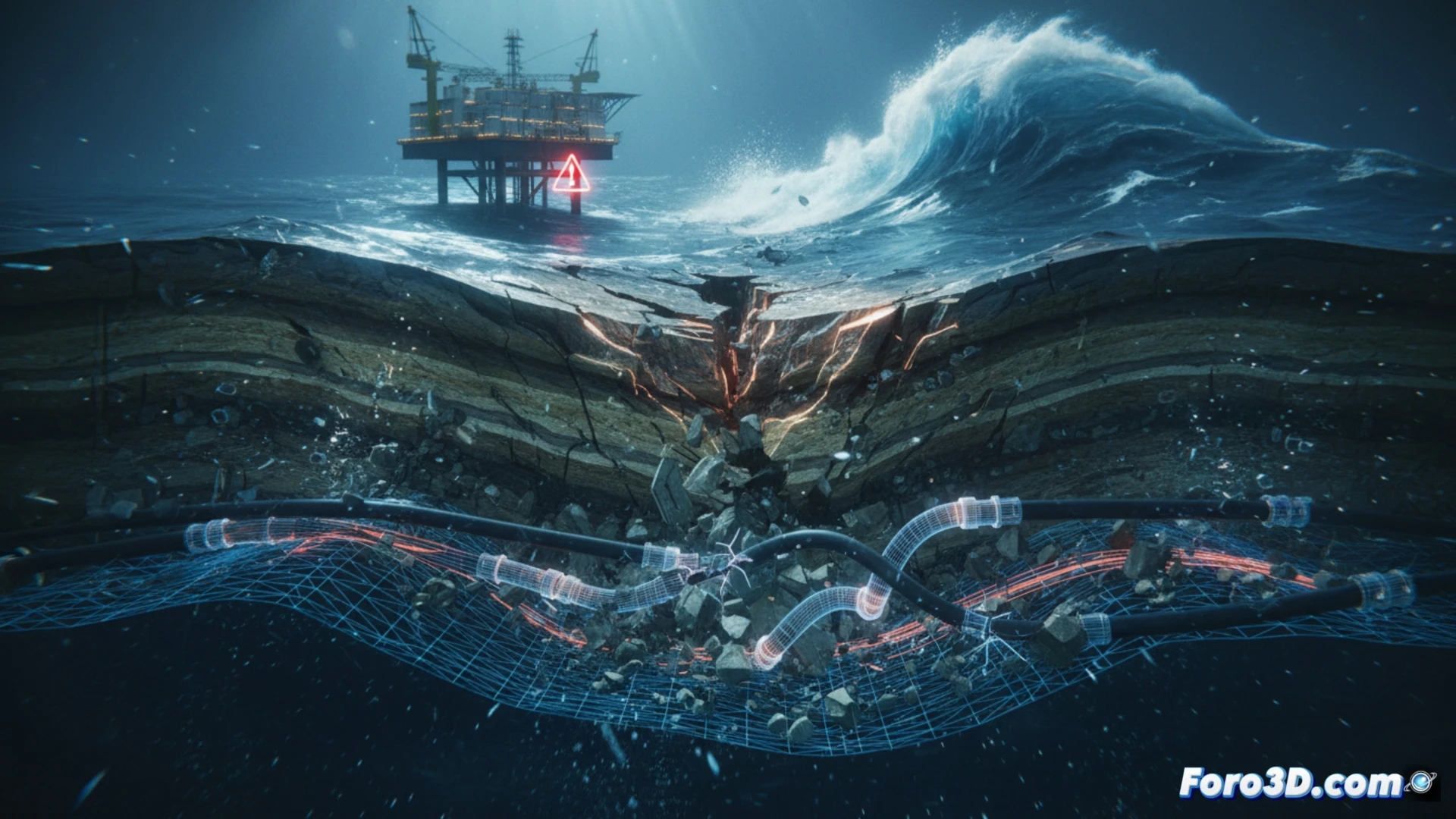
Subaqueous deformation represents one of the most complex and destructive phenomena in catastrophe engineering. When the seabed shifts due to an earthquake or landslide, the released energy travels through water and soil, compromising critical infrastructure such as pipelines, telecommunications cables, and oil platforms. 3D modeling has become an indispensable tool for visualizing and predicting these events, allowing engineers to anticipate structural failures before they occur.
Geotechnical simulation: tools and real cases 🌊
To analyze seabed deformation, specialists use finite element software such as FLAC3D, PLAXIS, or Abaqus, which integrate constitutive soil models like Mohr-Coulomb or the strain-hardening model. These tools allow simulating the collapse of submarine slopes after an earthquake, calculating the propagation of shear waves and sediment liquefaction. A landmark case was the Storegga submarine landslide in Norway, where 3D modeling revealed how the displacement of 3,500 cubic kilometers of sediment generated a tsunami that impacted European coasts. In modern projects, such as the Nord Stream gas pipeline, simulations helped identify critical zones where deformation could fracture the pipe, integrating high-resolution bathymetric data.
The future of prevention: predicting tsunamis from the seafloor 🌍
Beyond engineering, subaqueous deformation is key to understanding tsunamis generated by submarine faults. 3D modeling allows recreating the vertical displacement of the ocean floor during an earthquake, feeding hydrodynamic models that predict wave height and speed. However, uncertainty remains high: soil heterogeneity and the lack of real-time seismic data limit accuracy. The next frontier is integrating underwater sensors with digital twins, creating live simulations that alert coastal populations minutes before impact.
Which simulation methodologies allow for the most accurate representation of the interaction between fluids and sediments during catastrophic subaqueous deformation?
(PS: Simulating catastrophes is fun until your computer crashes and you become the catastrophe.)
Read more here: Source link